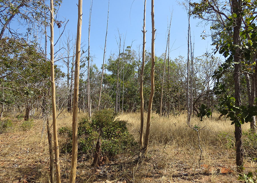
A pioneering study developed by Embrapa and the University of Brasília (UnB) used satellite imagery and artificial intelligence (AI) to map the abandonment of agricultural areas in the Brazilian Cerrado. Results obtained in the municipality of Buritizeiro, in northern Minas Gerais, indicate more than 13,000 hectares of abandoned agricultural land between 2018 and 2022, equivalent to almost 5% of the existing agricultural area at the beginning of the period. This detailed mapping represents the first assessment of its kind in the biome and can guide public policies aimed at ecological restoration, carbon accounting, and sustainable territorial planning. The studies were conducted by teams from Embrapa Cerrados (DF), Embrapa Agricultura Digital (SP), and Embrapa Meio Ambiente (SP), in addition to UnB. The research used images from the European Space Agency's (ESA) Sentinel-2 satellite, combined with deep learning techniques, to map changes in land use and land cover. Using a Fully Connected Neural Network (FCNN), a computational model capable of recognizing patterns in images, researchers were able to classify different categories: native vegetation, cultivated pastures, annual crops, eucalyptus plantations, and, for the first time, abandoned agricultural areas. The mapping accuracy was 94.7%, considered excellent for land use classifications using remote sensing. According to the survey, most of the abandoned areas (87%) correspond to former eucalyptus plantations intended for charcoal production. The municipality of Buritizeiro stands out for its extensive area planted with eucalyptus, in addition to cattle ranching. “The region is characterized by productive challenges, such as low pasture productivity during dry periods and increasing costs of fertilizer inputs, factors that contribute to the abandonment of agricultural areas,” says Embrapa Cerrados researcher Edson Sano. According to him, based on the analyzed images, scientists identified that most of the abandoned areas corresponded to eucalyptus plantations, both poorly maintained and those that transitioned to grassland or shrub vegetation after timber extraction. “The predominance of abandonment in eucalyptus areas is associated with the decline in the economic attractiveness of charcoal production due to factors such as increased logistics and production costs. The main destination for charcoal was the steelmaking hub in the state of Minas Gerais, in Sete Lagoas,” explains Sano. According to the researcher, in addition, the increase in fertilizer and agricultural input prices has encouraged the discontinuation of productive activities. “Although most of the abandoned land was identified in forestry areas, no significant abandonment of annual crops (such as soybeans or corn) was observed in the analyzed period. This suggests that more intensive agricultural systems maintained their productivity over the five years analyzed,” he adds. :: Implications for Public Policies According to Gustavo Bayma, an analyst at Embrapa Meio Ambiente, the maps generated by this methodology provide detailed spatial information on land abandonment. This data can be used to include underutilized areas in national strategies for environmental restoration and climate change mitigation. Such strategies may consist, for example, of estimating carbon sequestration potential or creating ecological restoration corridors in the Cerrado. “The study also highlights the importance of policies that reduce the volatility of agricultural input prices and encourage sustainable economic alternatives for small and medium-sized farms, since economic factors were identified as an important driver of pasture abandonment in the region,” says Bayma. He notes that the research shows, however, that monitoring still faces limitations, such as the need for longer historical series to separate permanent abandonment from temporary fallow periods (land resting for a year or less). Even so, the results demonstrate the potential of artificial intelligence technologies to support public policies for environmental restoration, territorial planning, and adaptation to climate change in the Cerrado. “The analysis was based on only two image acquisition dates over a four-year period, which prevents a precise distinction between permanent abandonment and temporary fallow practices. Although the use of high-resolution images and auxiliary visualizations helped in the validation, confirmation of abandonment still depends, in part, on visual interpretation and local knowledge,” adds Embrapa Digital Agriculture researcher Édson Bolfe. Another challenge he highlighted is the difficulty of differentiating degraded pastures from native vegetation (such as grasses and shrubs) using only remote sensing, since their spectral signatures can be very similar. According to the experts, the study proved that deep learning methods, combined with satellite imagery, can map abandoned agricultural lands in the Cerrado in a robust and precise way, an important methodological advance for the evaluation of land-use transitions in tropical savannas. “The results reinforce the need to incorporate abandoned areas into environmental and agricultural policies, with a view to ecological restoration, climate mitigation, and rural sustainability,” says Bolfe. More detailed information about the study is available in the article "Putting Abandoned Farmlands in the Legend of Land Use and Land Cover Maps of the Brazilian Tropical Savanna."
This text was translated by machine from Brazilian Portuguese.